How Far Science'll Go: HTTM Part 4
Note to self: do NOT give Magellan naming rights again!
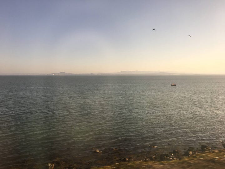
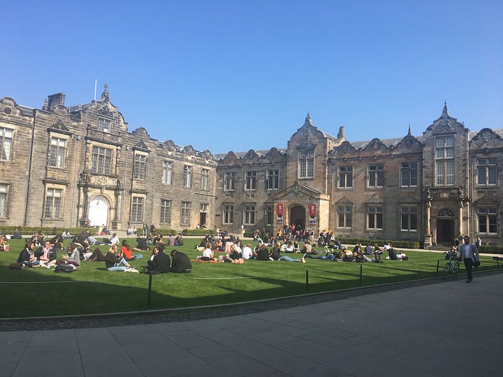
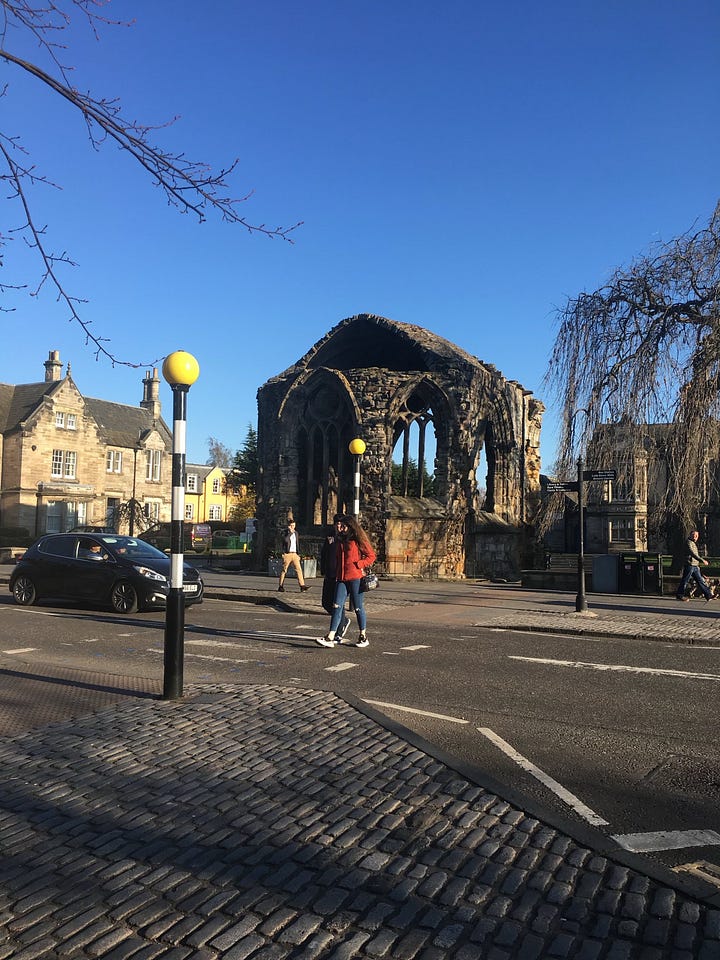
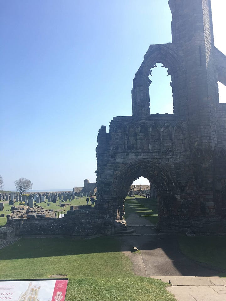
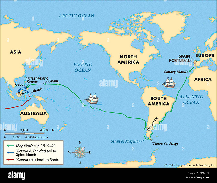
Scotland’s typical April weather is rainy with a chance of drizzle, but the first time I visited, clear skies and sunshine greeting me as I stepped off the bus in St. Andrews. The iconic seascapes and sandstone ruins came alive in the light, and students stretched out on every green space they could find as if the entire town was their backyard. My friend warned me not to get used to the welcoming weather since the sun had been absent for months, but first impressions of an environment can be a hard thing to shake — just ask Ferdinand Magellan, the first European to sail west of the Americas. After surviving a dangerous ill-informed exploration of Patagonia and a deadly mutiny, Magellan and his remaining crew found a narrow windy passage at the southern tip of South America. They sailed through what is now called the Straits of Magellan and entered a large body of water. In a burst of gratitude to the weather gods, Magellan named the area “Mar Pacífico,” aka the Pacific Ocean, because it seemed peaceful after the choppy conditions in the Straits.
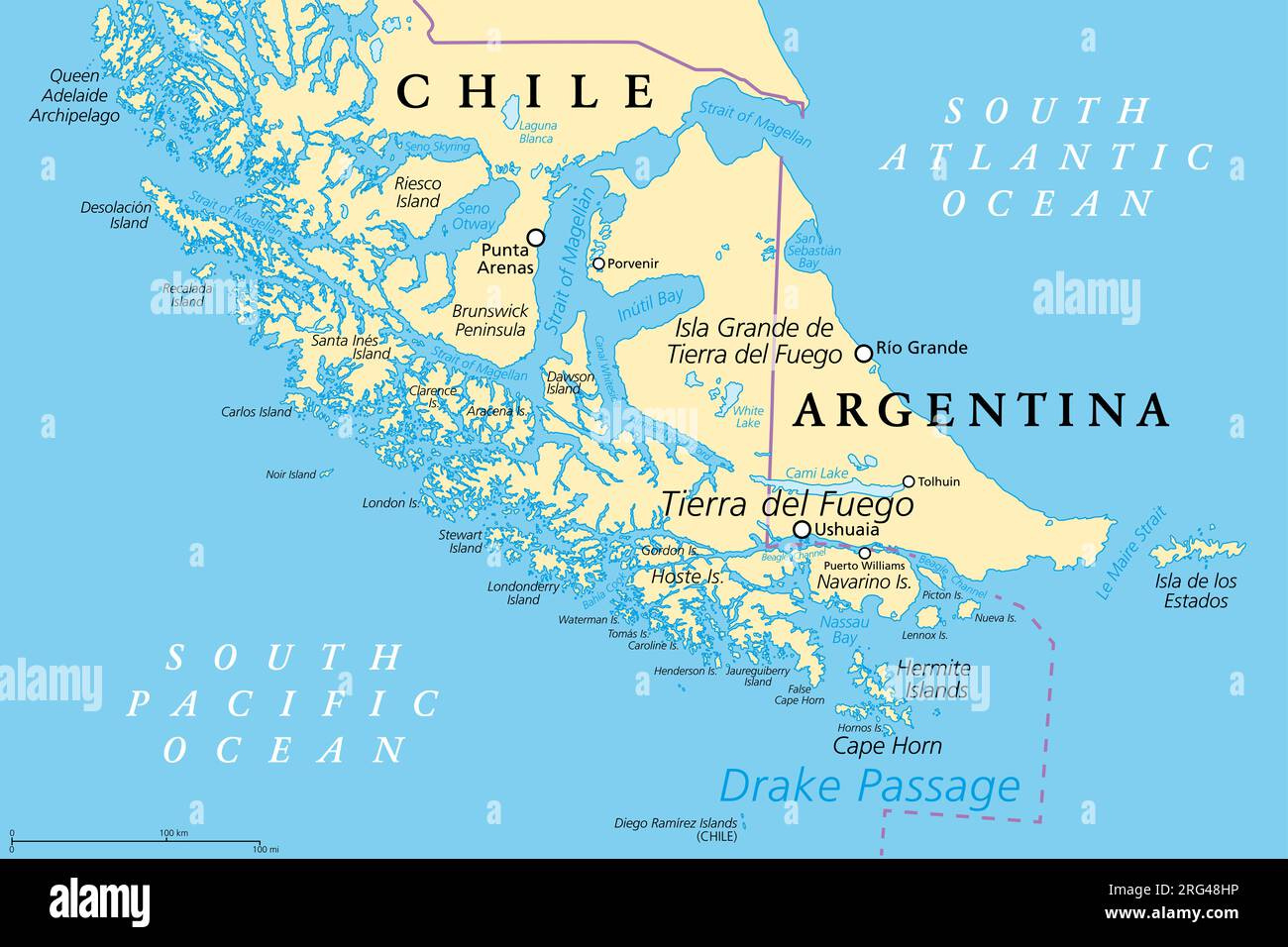
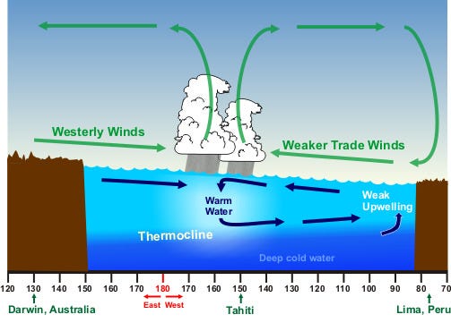
Magellan’s 7,863 nautical mile journey across the Pacific was characterized by weak winds and stagnant water. In the end it took him 99 days to stagger to the island of Guam, which is about 2/3rds the way across the ocean. Although the men were starving and had run out of fresh water, the calm weather conditions allowed them to reach dry land in one piece. Historical biographers often emphasized good luck or the role of God in Magellan’s journey, but modern-day weather historians have concluded that Magellan and his crew experienced an El Niño, which kept equatorial winds light and currents weak. Sea water temperatures were also above average, which likely made fishing less plentiful and could explain his crews’ extreme lack of food. During a particularly strong El Niño, like the one Magellan sailed through, equatorial winds can blow east instead of west. These reversed trade winds would have prevented his crew from sailing directly into Polynesia, where they could have gathered provisions from one of the thousands of islands. So, after making his way north to the equator, Magellan had to direct his ships further north because the direction of the winds had changed. This caused them to bypass the Spice Islands of Indonesia (their original destination) and settle in the Philippines, where Magellan was promptly murdered by native warriors.
Such insights into Magellan’s journey could not have been made without a subfield of climate science known as paleoclimatology. Paleoclimatologists examine the makeup of corals, tree rings, sediment & soil, and other environmental proxies to reconstruct historic weather and climate patterns. Their work is vital to oceanographers and meteorologists, especially those researching the origin of phenomena like the North Atlantic Oscillation or the El Niño-Southern Oscillation. Most of the climate oscillations we’ve discussed so far in this series are ‘mysterious’ in origin — that is, scientists have not determined whether the changes they represent come primarily from the atmosphere or ocean. When it comes to the Pacific, any discussion of its weather and climate focuses almost exclusively on El Niño, a pattern that affects the weather on both land and at sea. But at 63.8 million square miles, surely the Pacific is home to other important phenomena? In this fourth installment of Hot Tub Time Machine, we’ll examine the patterns that affect Earth’s largest environment and explore how different types of knowledge can help us understand the seas.
What’s going on in the Pacific?
As mentioned above, the El Niño Southern Oscillation (ENSO) affects weather on both sides of the Pacific. Although it mainly impacts atmospheric pressure, ENSO also causes a change surface-level ocean currents. When the atmospheric high shifts towards South America, it causes an east-flowing equatorial current to bring warm water to the coast of Chile, Ecuador, and Peru. This can slow down or temporarily halt a naturally-occurring part of ocean circulation called upwelling, which brings cold nutrient-rich waters to the eastern Pacific and allows for fisheries in South America to prosper. Indeed, the very name for this oscillation comes from the Spanish settlers, who noticed a striking change in the weather around Christmas time some years. Records referring to ‘El Niño,’ or the Christ child, appeared from 1578 onwards, not too long after Magellan himself experienced the phenomenon!
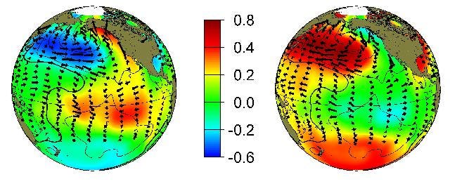
The climate in the Pacific is heavily dependent on sea surface temperatures (SSTs) in addition to atmospheric changes. The Pacific Decadal Oscillation describes long-term patterns of water temperatures north of the Equator. The PDO is considered to be in its positive phase when SSTs are high and sea level is elevated in the eastern Pacific— remember, water expands as it warms, which causes sea levels to rise ever so slightly. This excess heat brings extra rainfall to the southwestern coast of North America and drier conditions to East Asia and most of the South Pacific. During a PDO-negative phase, this area of warmth moves to the western Pacific, bringing drier conditions to North America and causing excess precipitation as far away as India!
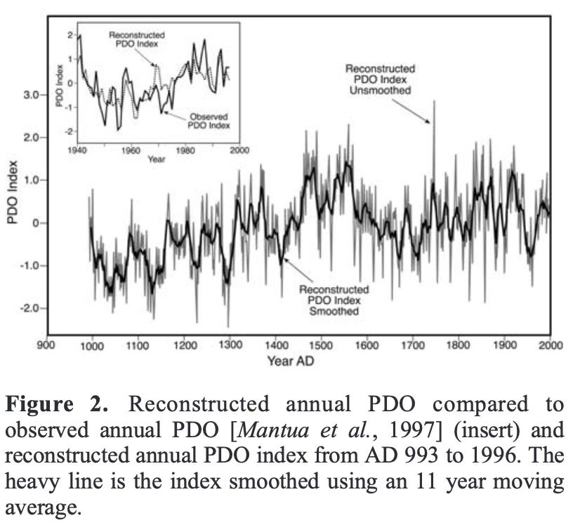
The PDO is thought to influence the strength of ENSO because it controls where in the ocean warmer-than-average water can be found. In 2005, paleoclimatologists used data from tree rings in California and British Columbia to reconstruct the PDO’s strength over the past 1,000 years. As you can see from the graph below, the PDO was predominantly negative until around 1450 CE, when it switched into a 150-year positive phase. This means that during Magellan’s journey, waters in the eastern Pacific were abnormally warm, which could account for the strength of the El Niño he and his crew experienced (and the first-ever recorded incidence of an El Niño occurring shortly after).
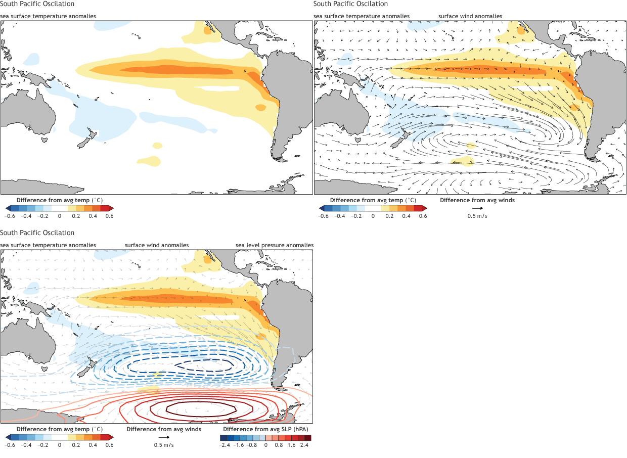
Another large-scale climate pattern is the South Pacific Oscillation, which affects SST anomalies off the coast of South America and across Polynesia. The SPO is most active during June-July-August and, as illustrated by the gif below, is a measurement of sea surface pressure similar to the North Atlantic Oscillation (which was covered in HTTM Part 1). Only in the past decade have scientists concluded it is a separate phenomenon that interacts with both ENSO and the PDO. Just last year scientists revealed that the center of high and low pressures during the SPO has shifted steadily eastward, closer to the coast of South America, since the 1960s. They claim this movement may be weakening El Niño events, implying that the SPO could actually be mitigating the strength of El Niños — imaging how much worse monsoon season and winter snowstorms would be without the SPO…!
Is climate change affecting the Pacific Ocean’s oscillations?
Yes, but the magnitude of change has yet to be determined. Recent studies have shown the modality of the PDO to be shortening. Scientists first named this phenomenon in 1996 when a group of researchers at University of Washington studied the effect of climate change on salmon populations in the Pacific Northwest. While meteorologists consider each phase to last 20-30 years, recent studies have shown that the PDO’s periodicity has varied considerably in recent decades because the ocean is warming and its circulation slowing. The PDO is important because one of its main roles in our contemporary climate is to mitigate marine heatwaves, which threaten biodiversity in the tropics. When the PDO is negative heatwaves are less pronounced, but studies have shown a positive PDO can make heatwaves last as much as 43% longer than normal…!
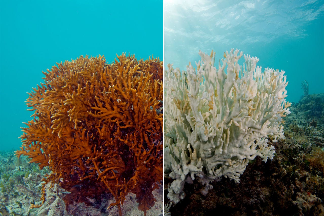
Despite this urgent risk, climatologists have yet to determine whether the PDO’s positive phase will become stronger and/or more durable in future decades. Similarly, since the SPO was only recently ‘discovered’ any papers predicting its strength and movements are few and far between. Even if research is currently being conducted, it will likely take years to go through the peer review process and become public knowledge. So what’s to be done in the meantime?
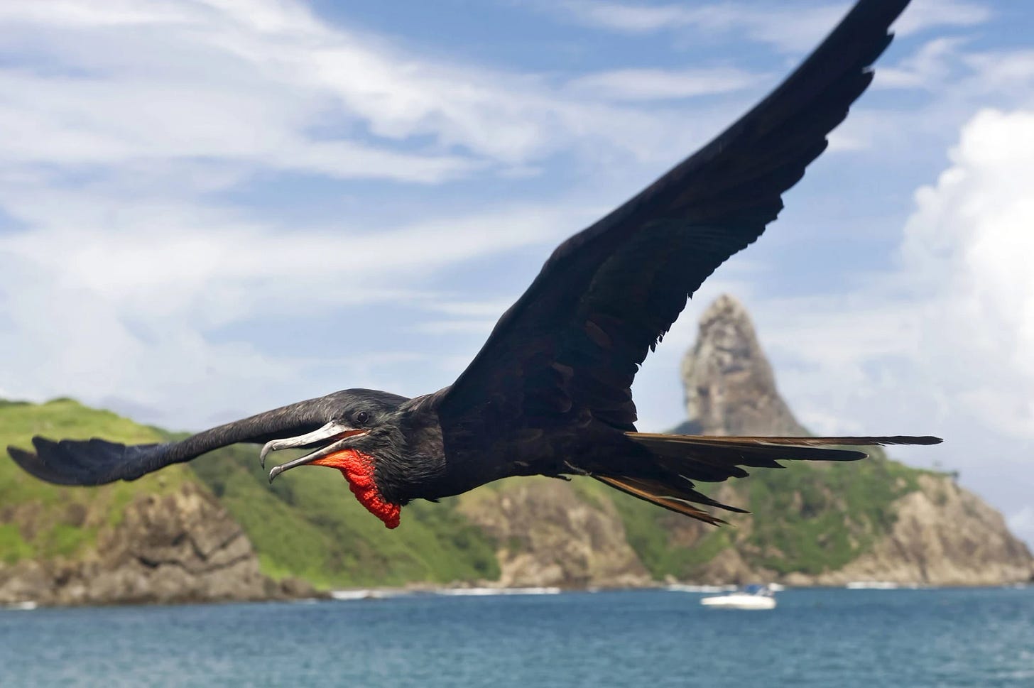
Oftentimes, in the fight against climate change, it is the uncertainty that affects people most. Waiting for policy to catch up with facts is one thing, but what if the ‘science’ itself is happening too slowly? Thankfully, Pacific Islanders and other indigenous coast-dwelling peoples have been collecting information about marine environments for centuries. Recent studies have supported the veracity of indigenous knowledge: since 2004 there has been a growing body of scientific literature that proves the metal of cultural and site-specific knowledge. Just last year researchers Nunn et. al. found “plausible scientific basis” for Pacific Islanders’ traditional methods of predicting climate and weather. For example, residents of Tonga interpret the frigate bird flying low across the island as a sign of an impending cyclone. Similarly, Western research has shown frigates developed acute sense of the wind because they spend most of their time on the open ocean; as a result, the birds avoid severe weather by sheltering on islands.
Another 2024 study integrated traditional knowledge of the ni-Vanuatu people with water monitoring data to more accurately predict fishery health. All in all, these projects conclude that combining scientific with traditional knowledge will help coastal & island communities adapt quicker and more effectively to climate change.
Conclusion: More than one threat to tradition
Unfortunately, new evidence suggests that the plants and animals used by indigenous islanders to indicate short-term climate phenomena are losing their accuracy. The VanKIRAP Project, which monitors indicator species on the island of Vanuatu, notes that day-to-day weather forecasting remains unaffected but species which indicate seasonal or month-long climatic changes are themselves threatened by climate change. While VanKIRAP is currently conducting year-round observations of habit or habitat changes, there are no such local monitoring groups on any of the other thousand Polynesian islands. Most of the funding for such projects comes from Western nations, which have historically dismissed the veracity of islanders’ cultural attunement to the ocean. While the 21st century has brought an increased interest in indigenous perspectives, global policy is still hindered by the Western view of the sea as a frontier to be explored and examined, not a place people depend on for harmony and security.
With the advent of Asian American-Native Hawaiian-Pacific Islanders (AANHPI) Heritage Month and movies like Moana, island voices are becoming less marginalized, at least in theory. I will note for all Moana movies’ promotional videos, not one mentioned that ‘moana’ means ‘ocean’ in Hawaiian, which could have deepened viewers’ understanding of the story. Learn more about AANHPI’s connection to the sea by watching the video below:
Ultimately, science should be seen as an augmented form of traditional knowledge instead of a replacement for it, at least in terms of the ocean. In the previous decade several landmark papers were published encouraging policymakers to take indigenous knowledge into account when planning for climate change. With this academic backing, the 2022 UN International Panel on Climate Change Report made supporting and utilizing indigenous practices, observations, and conservation strategies a key recommendation. Instead of seeing the ocean as representative of Other cultures, or as an environment external to ourselves, leaders in the fight against climate change should elevate indigenous oceanic perspectives — I’m sure Peter Thomson would appreciate some company in the spotlight!

Sources not linked above
WHOI List of Climate Oscillations | NASA Jet Propulsion Lab PDO | Weather.gov ENSO explanation | Princeton University Library history of European exploration in the Pacific | Royal Museums Greenwich Magellan info | Bay Nature Magazine history of ENSO | PreventionWeb Pacific Islanders traditional knowledge examples | MacDonald, G. M., and R. A. Case (2005). Variations in the Pacific Decadal Oscillation over the past millennium. Geophysical Research Letters, 32(L08703), doi:10.1029/2005GL022478. | Min, Q., and Zhang, R. (2024). The Interdecadal Changes in the Spatial Structure of the South Pacific Oscillation and Its Implication for ENSO Diversity. Journal of Climate, 37(15), 4011-4029. https://doi.org/10.1175/JCLI-D-23-0277.1 | Nunn, P. D., Kumar, R., Barrowman, H. M., Chambers, L., Fifita, L., Gegeo, D., Gomese, C., McGree, S., & Rarai, A. (2024). Traditional knowledge for climate resilience in the Pacific Islands. WIREs Climate Change, 15(4), e882. https://doi.org/10.1002/wcc.882 | Ren, X., Liu, W., Capotondi, A. et al. The Pacific Decadal Oscillation modulated marine heatwaves in the Northeast Pacific during past decades. Commun Earth Environ 4, 218 (2023). https://doi.org/10.1038/s43247-023-00863-w | You, Y. and J. C. Furtado (2017). The role of South Pacific atmospheric variability in the development of different types of ENSO. Geophysical Research Letters, 44, doi:10.1002/2017GL073475.

So much we could learn from peoples of the south pacific regarding how to measure effects of ocean currents & how they determine climactic events. While the different oscillations can be confusing ( at least to me ) they should be studied in more expansive forums ( lectures , videos etc. ) to educate citizens -particularly government representatives- to take important steps in mitigating fossil fuel dependence . The Influence of corporate money interests has to be overbalanced by public action.